
In science, we studied the adaptations made to Philadelphia’s map over time. We examined https://www.philageohistory.org/geohistory/ , and wrote about how the map evolved around the city’s needs.
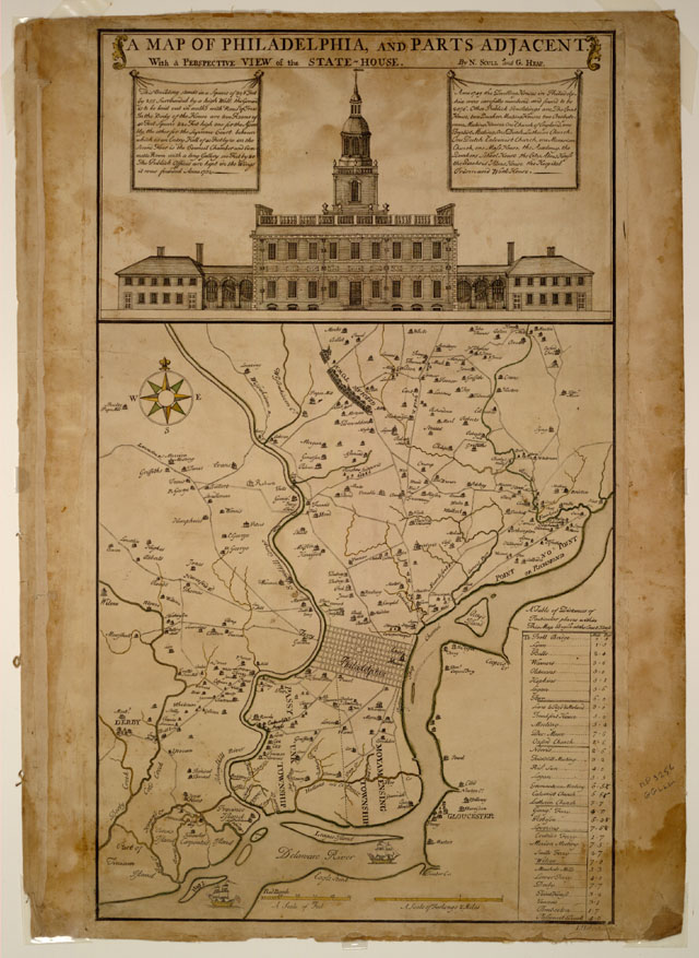
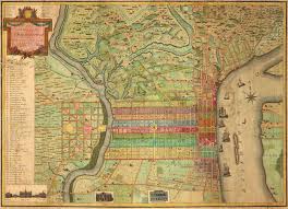
Since the establishment of our city, community members have adapted Philadelphia maps to meet the needs of the continually escalating population. Residents made it necessary to have accessible transportation, the exportation of goods, and a stable city structure; moreover, these are all aspects that affect a city map. In 1750, there was an increasing population of about 20,000 residents; this affected the structure of what was reflected on the city map. Philadelphia’s map showed a grid to help navigate through the growing city. The city is surrounded by The Schuylkill and The Delaware River for easy access to a water source. Due to a small population at the time, houses were named after the families that lived in them. There were barely any streets, and City Hall is in the same place that it is today. The popularity of the city grew, which lead to significant changes on the map. In 1855, with a growing population of 121,376 residents, the city was split up into wards and sections. A large population forced them to divide the city to create organization and sustainability. It also lead to much improvement in the development of streets to make transportation easier for Philadelphia’s citizens. Houses and roads were no longer named after families since the population increased, and important buildings were labeled on the map for navigation. Street names are now similar to today’s (Chestnut, Race, Walnut), and City Hall is still in the center of the city. Rittenhouse and Washington Square were shown on the map for navigation and recreational purposes. The development of Philadelphia greatly affected what is shown on the city’s maps.
Philadelphia maps advanced continuously in the 18th- 20th centuries due to the growing population. In 1910, with a population of 1,549,008 people, Philadelphia showed a new city structure. A large population made exporting goods necessary; piers were built among The Delaware River for the start of the Industrial Revolution. Parks began to develop on the maps to be used for recreational purposes and filtration processes for dirty rainwater that will seep into the waterways. Railways are shown for transportation as many residents pile into the city, making Philadelphia a focal point. Basins and waterworks were constructed for the city’s water infrastructure because residents made stable water distribution necessary. Alterations to the map created Philadelphia’s history, inevitably affecting where our city is today.
